

Loch Eriboll and region. Click to enlarge.
Loch Eriboll is a sea loch along the northern coast of Scotland, roughly 16 km (10 mi) long. It’s been used (probably as long as inhabitants were in the area) as a safe anchor from the stormy seas off of Cape Wrath and the Pentland Firth. Bronze Age remains can be found in the area, including the souterrain I wrote about recently. There’s also a well-preserved wheelhouse on a hillside above the western shore, and on the small peninsula jutting out into the loch you’ll find the ruins of a small scale lime industry that developed there in the 19th century. The shores around the area are fascinating, as the geological composition is a conglomeration of an amazing variety, split along the eastern shore of the loch by the Moine Thrust. Even along the roads, you’ll find chunks of pink metamorphic rocks glittering with mica.

Loch Eriboll, taken Summer 2012, © Stephanie Huesler. Click to enlarge.
In 1945, thirty-three German U-boats surrendered in the deep loch, ending the Battle of the Atlantic. Eilean Choraidh, the largest island in the loch, was used as target practice for aerial bombing due to its size and resemblance to the shape of a ship. Along the western hills, you can see words written with stones near the settlement of Laid: They are the names of warships, such as the Hood and Amethyst, arranged there by the sailors of those ships.
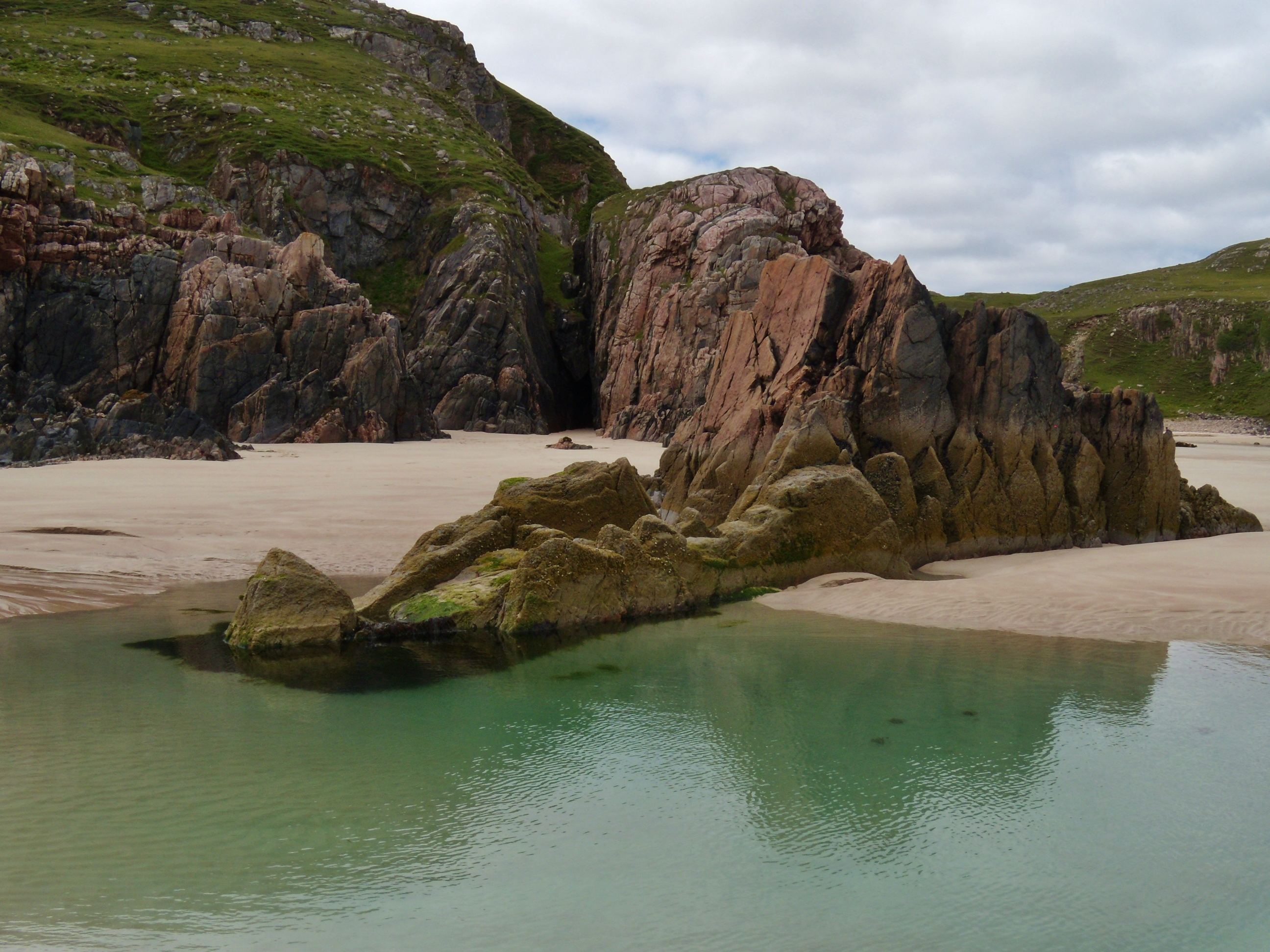
Tràigh Allt Chàilgeag Beach, taken Summer 2012, © Stephanie Huesler. Click to enlarge.
Not far from Loch Eriboll, on the way to Durness, is a treasure: Tràigh Allt Chàilgeag is a beach of vertical walls of stones layered in colours ranging from black to pink. When the tide is out the beach is endless, and when it’s in, climb the rocks! The beach was created as the Ice Age sheets began to melt, pushing the walls of rocks upward as the island actually rose, no longer being held down by the massive weight of ice.
On a clear day, you can see the southern-most Orkney Isles, and the waters around the coast are still busy highways for ships of all sizes.
My husband and I were on holiday in Scotland in 2012, and we spent several days in this area so that I could do research for The Cardinal; both the souterrain and the above-mentioned beach play a role in the story.
History Undusted, September 7, 2013


