Category Archives: Snapshots in History

History Undusted: Jumièges Abbey

Jumièges Abbey is one of the oldest Benedictine monasteries in Normandy; to dive into its history is akin to diving down Alice’s rabbit hole. For instance, I could say that the abbey was sponsored by the Frankish Queen Balthild, as she persuaded her husband, King Clovis II, to donate land to the Frankish nobleman Filibertus in order to found an abbey. But to know who she was, ah, that is where the intrigue begins.

Who and where were the Franks, when were they a thing, and what are they to us today?

Who, where and when: They were a Western European people who began as a Germanic people along the lower Rhine (which flows from Bonn, Germany, and ends up in the North Sea at the southwestern corner of the Netherlands), along the northern frontier of the Roman Empire. During the Middle Ages, they expanded their scope of rule as the Western Roman Empire began to collapse, and they imposed their power over many post-Roman kingdoms and beyond. That’s the crux of the matter though, as with any political history, it’s far more complex than that. The Franks are distinguished into two main groups by historians: The Salian Franks, to the west, and the Rhineland Franks, to the east.

In the mid-5th century, The Salian king, Childeric I, was a commander of Roman forces against the Gauls, most of whom Childeric and his son, Clovis I, conquered in the 6th century. Clovis was the first king of the Franks to unite the Frankish tribes under one ruler, and he founded the Merovingian dynasty – which ruled the Frankish tribes for 2 centuries. Clovis, in essence, is known as the first king of what would become France. As a side note, the Frankish name of Clovis is at the root of the French name of Louis, borne by eighteen kings of France.

Now, back to Queen Balthild (AD 626 – 680): Sold into slavery as a young girl, she was beautiful and intelligent. She served in the household of Erchinoald, the mayor of the palace of Neustria to Clovis II. Her master, a widower, wanted to marry her, but she hid herself from his sight until he married someone else (apparently the household of servants was numerous enough to enable her to avoid her unwanted suitor). Perhaps through Erchinoald’s notice of her, she came to the attention of Clovis II, who proposed to her and was accepted; hiding herself away may have been a political tactic to gain a higher rank with the king than with the mayor; According to the Vita Sancti Wilfrithi by Stephen of Ripon (written around AD 710), Bathild was a ruthless ruler, in conflict with the bishops and perhaps responsible for several assassinations. Some historians interpret Queen Balthild’s association with founding monasteries as a way of balancing or neutralizing aristocratic opposition to her rule. By installing her own bishops and donating lands for abbeys, she strengthened her own power as ruler (she was regent during the minority of her son). To put that in proper perspective, she was no different than most male counterparts of her day. [I could go off on a tangent about how adjectives differ when applied to the male or female state of affairs (a man is ambitious; a woman is pushy or ruthless), but I won’t. Yet.] From most accounts, however, she was pious and humble. Whichever way you butter that croissant, in ca. 860 she was canonized, thereafter to be referred to as Saint Balthild…

In 654, Balthild gave a parcel of royal land to Philibert, or Filibertus, on which he founded the Notre Dame de Jumièges. His main spiritual influence was that of the Irish monk, Columbanus (who founded several monasteries in the Frankish and Lombardi kingdoms).  The abbey flourished until the Viking invasions of 841 (Remember Rolf Ganger?), which caused disruptions to its first momentum, but it soon began to prosper again. The church itself was rebuilt between 1040 and 1066; it was dedicated on 1 July 1067, with none other present than William the Conqueror, Duke of Normandy and King of England (1066 and all that). The patronage of such a nobleman ensured the abbey’s success.

Jumièges Abbey was, like any abbey of its time, a veritable town. The church was only the heart of the community; there was a 14-acre enclosed park, terraced gardens, the abbatial manor, a bakery, landscaping to evoke biblical scenes, a hostelry, the 14th century “Charles VII” walkway (a covered walkway between the Notre Dame and St Peter’s church, named after the fact that Charles VII and his favourite mistress visited the monastery), and the cloister.

The next major disruption was from 1415, when the monks were forced to regularly seek refuge in Rouen as the English occupied Normandy during the Hundred Years’ War. The abbey eventually recovered and began to flourish again, until the whole province was plunged into the chaos of the Wars of Religion (1562-1598), resulting in the population’s decimation and famine. In 1649, the abbey was taken over by a Benedictine congregation, when some of its former glory was revitalized. Having survived all of that, its ruin came at the hands of the French Revolution, when it was sold as a “national property” and turned into a stone quarry (seen only as a source of ready-cut stones). At last, its historical value was recognized in the 19th century, putting an end to its wanton deconstruction.

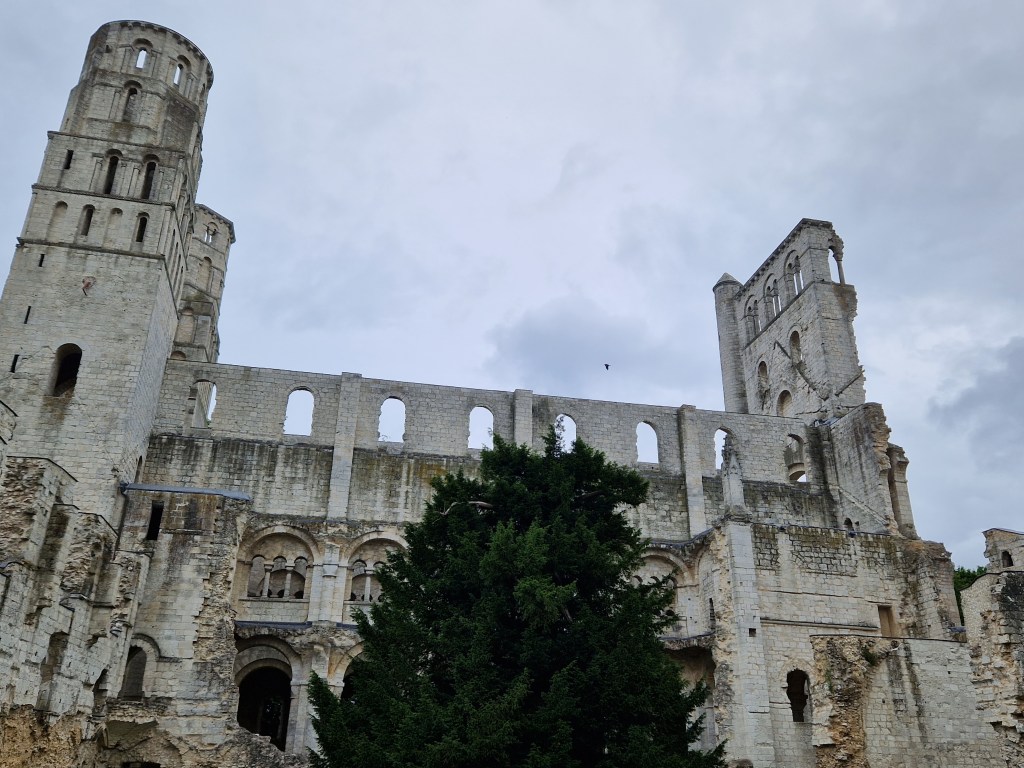
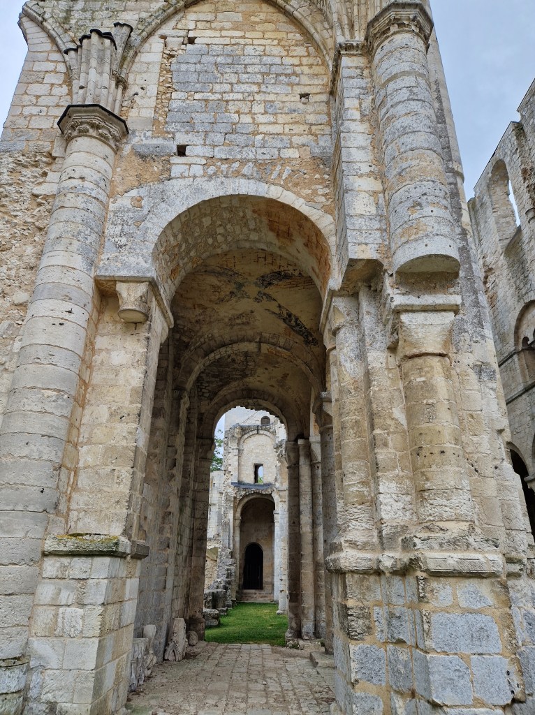
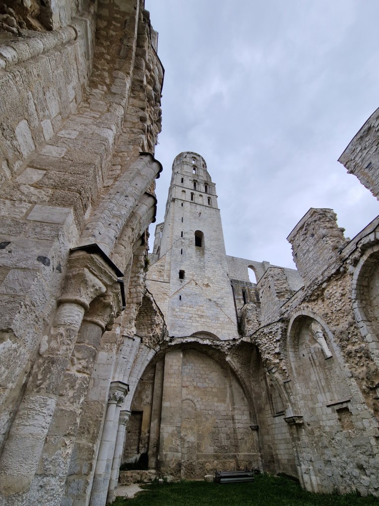
When we visited the abbey last summer, its grandeur, although only ruins today, is still evident; when it was at its height of prosperity, it must have been an awesome sight to behold! In the photos below, which I took during our visit, you can see evidence of the various phases of destruction and reconstruction. Enjoy!
2 Comments

Filed under Articles, Etymology, History, History Undusted, Military History, Snapshots in History

History Undusted: The Great Clock of Rouen, France

Last summer, my husband and I rented a privately-owned motorhome in Caen, France, and travelled around Normandy for 10 weather-perfect days. One of the places we had on our short list to see was the city of Rouen, a region with a long and rich history. One icon of the city is a clock. Not just any clock. The Great Clock of Rouen.

Rouen was a pivotal location in the Hundred Years’ War (1337-1453 – calling it the “Hundred-and-Sixteen Years’ War” is more accurate but not as catchy, though the name is likely based on the fact that there were periods of fragile truces); the central conflict was the English claim to the French throne. In the context of this war, Joan of Arc became a victim of male chauvinism and political expediency. But that’s another story.

The mechanism of this clock was built in 1389. Let’s put that into perspective: That’s over 100 years before Columbus set out to discover a western passage to the East Indies and inadvertently discovered America; Richard II took over as king of England; it was made during the Hundred Years’ War; Joan of Arc would have seen this clock on her way to her execution (by burning at the stake). It was made more than 190 years before our modern Gregorian calendar replaced the Julian calendar, in 1582.

The mechanism deserved not only a grand position, but a grand façade: The Rouennais aldermen decided that the town needed a clock, and the construction of a tower to house the clock took 9 years; the architect was Jehan de Bayeux, though the tower was completed by his son in 1398. The original designer of the clock’s facades, Jordan Delettre, was no more (whether he died or was removed is unknown), and it was completed by Jean de Felain, who became the first “governor of the clock”, maintaining it in exchange for a home in the clock’s tower. Towers and wars came and went, and the clock survived; it was moved to its current location in 1410, now housed astride an ornately carved stone archway.

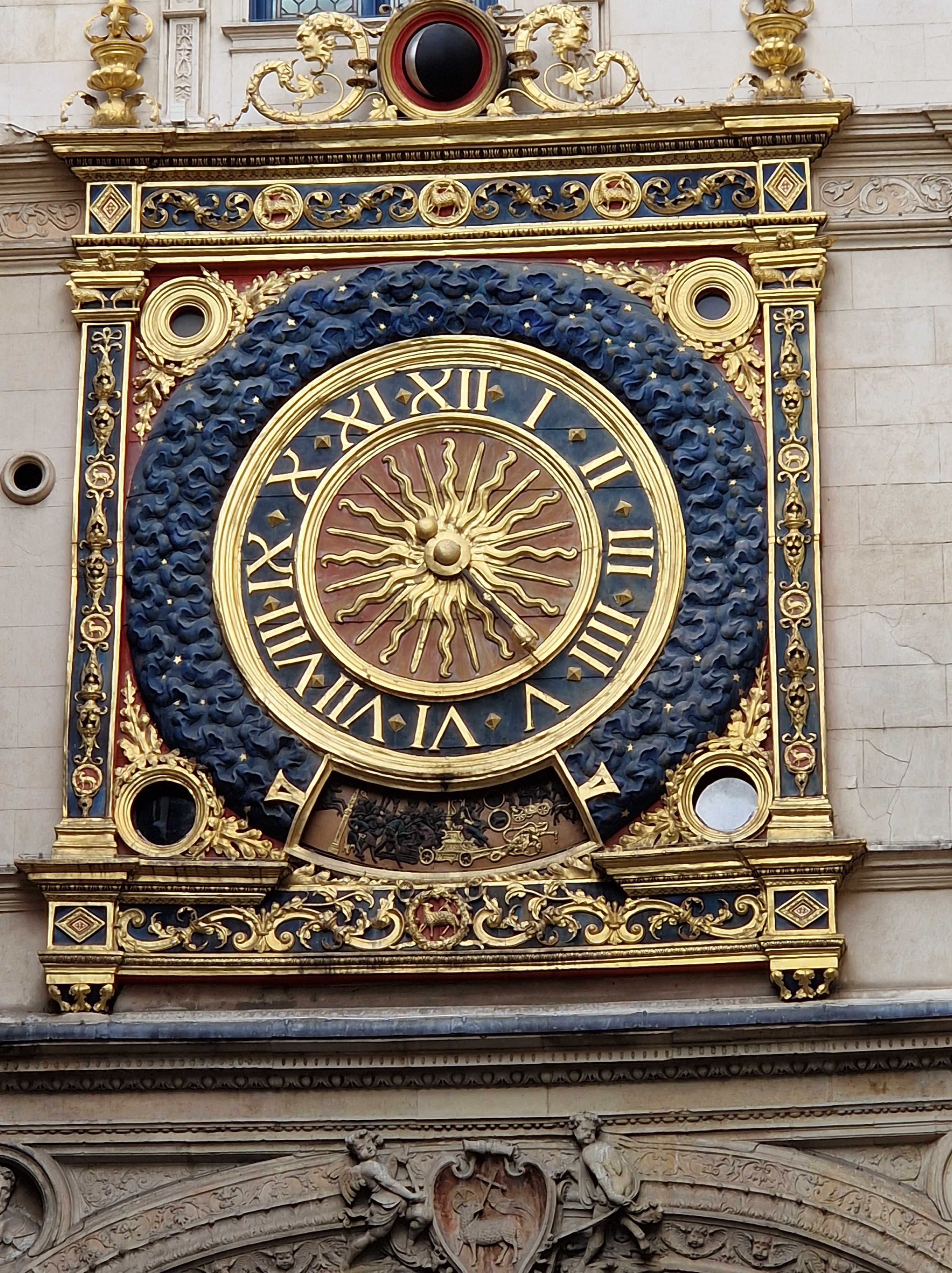
The clock faces (on both sides of a stone archway and connected to a central mechanism shared by both) are 2.5 metres (over 8 feet) in diameter, and each has only a single hand, tipped with the depiction of a lamb, which shows the hour; moon phases are indicated in the 30 cm oculus above the clock face, which makes a full rotation every 29 days. The face depicts 24 rays of the sun surrounded by a dark blue starry frame. A hand which shows the day of the week is located in an opening at the base of the dial, with each day represented by a different Greek god: Diane as the moon (Monday), Mars (Tuesday), Mercury (Wednesday), Jupiter (Thursday), Venus (Friday), Saturn (Saturday) and Apollo (Sunday).

Although the mechanism of the clock still works, it has been powered by electricity since 1928, and the tower itself was renovated in the late 1990s.

Underneath the clock in the centre of the archway, the coat of arms of Rouen can be seen: It depicts the Paschal lamb on a red background (the official colour of Rouen); it is held by two angels (if you look closely at the angel on the right, you’ll notice that its head is on wrong; it is thought to be due to disgruntled construction workers – obviously an age-old problem…). Beneath the arch are elaborate bas-reliefs of Jesus as the Good Shepherd caring for his flocks; the clock’s hand, the coat of arms and the reliefs all echo the importance of textile and wool trade to the city. One clock face alone has at least 15 sheep (zoom in on the picture of the clock and see if you can spot them all!). Next to the clock is a Gothic belfry tower built in the 14th and 15th centuries which houses the bells connected to the clock, which ring on the quarter-hour.

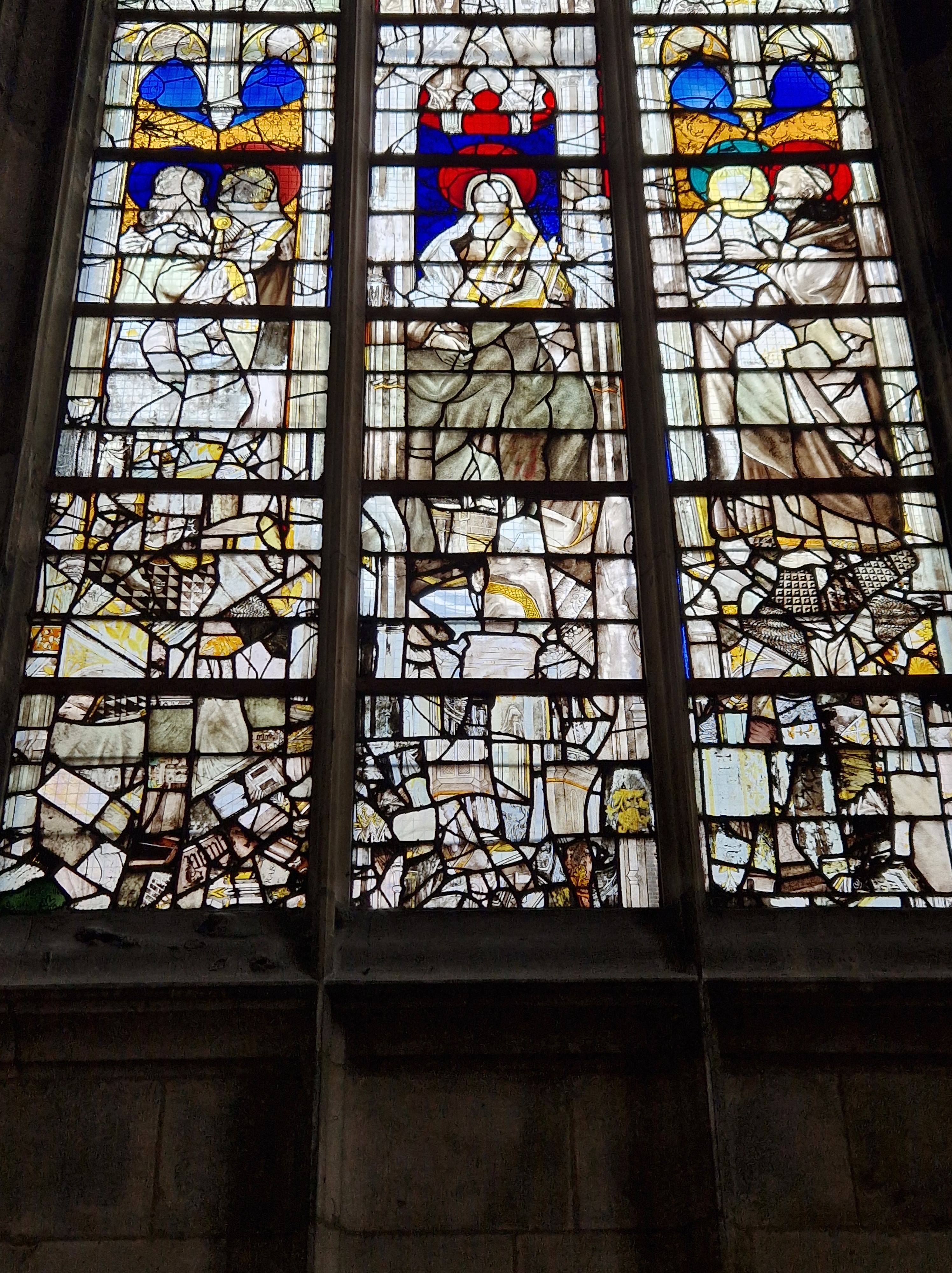
Rouen is a survivor: It has outlasted Viking raids that travelled up the Seine River, the Hundred Years’ War, the Religion Wars of the Renaissance period, the Franco-Prussian War of 1870, the French Revolution, and even World War 2; the latter damaged nearly half the city, and shrapnel and bullet scars can still be seen in façades. The cathedral’s stained-glass windows were shattered by a WW2 bomb and were subsequently reconstructed using the fragments, creating jumbled images that reflect its history and its survival.

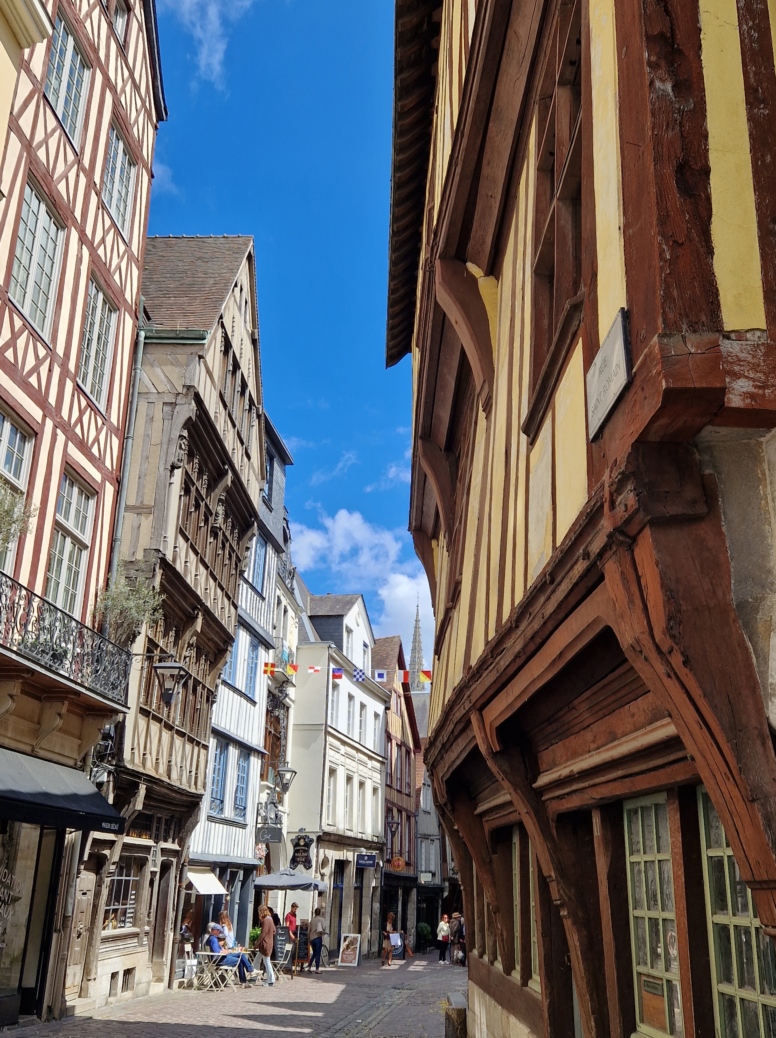
For me, the clock must really be seen within its context to truly appreciate it; it’s surrounded by wonky Medieval buildings which are three or four stories tall and built when plumb lines and uniformity were still futuristic concepts. They were built out of timber, as there is abundant forest nearby but no stone quarries.

The clock adorns the arch over the Rue du Gros-Horloge (“Street of the Great Clock”), which runs between the Gothic cathedral, made famous by Claude Monet (who painted over 30 canvases centred on the cathedral), and the old market square, where Joan of Arc was burned at the stake. Perhaps ironically in light of the latter event, the street just off of the clock’s archway is called Rue Massacre

Though I do not speak French, I know that in French, clocks today are referred to in the feminine form, la horloge; but prior to the 18th century, clocks were masculine; so, the great clock of Rouen, in French, is still Le Gros-Horloge.

Below are a few of our holiday photos: They include the cathedral’s jumbled windows and the clock from various angles, as well as a few of the wonky buildings. Enjoy!

5 Comments

Filed under History, History Undusted, Military History, Science & Technology, Snapshots in History

Virtual Tour: Vintage Switzerland

I’ve been preparing my manuscripts for new releases through a new publisher, and making crafts for our church’s annual craft sale; in the latter process, I’ve discovered a wealth of images through Pinterest (nothing new to me in itself). How many of you used to collect stamps, or postcards, or specific objects? For me, the new method is Pinterest. You can find stamps on any topic, and rare ones; you can find coins, bank notes, and just about anything you used to collect physically, now available at a click with historic backgrounds and full details you could never have fit into an album.

But today, I’d like to focus on Vintage travel posters, specifically for Switzerland. So far, I have nearly 350 in my collection, and it’s likely a drop in the bucket of what was produced; every region advertised itself to attract tourists or travellers, and it’s fascinating to see what they highlighted, how they did so, what their perspective was, and how the people dressed (if they’re shown – in Switzerland, at least, a big focus is on the Alps). Did you know that the word “homesick” in English came from Switzerland? The Swiss merchants that travelled abroad in the 17th century took the word with them; when they spoke of “Heimweh”, however, they weren’t referring to people, or their home, or even their town, but of the mountains. They missed the Alps when they were away… and I can understand why. I think it must run in the veins of every Swiss-born person; when my husband and his mother speak of the mountains, it’s a foreign language to me (even though I’m fluent in Swiss German!).

We might tend to think of tourism as a modern thing; but Grand Tours began in the 17th Century, when wealthy young men, and sometimes women, would embark from the UK on a European tour. At the beginning, Switzerland was a sleepy backwater in some ways – there were few, if any, hotels – if a traveller arrived in a town seeking accommodation for themselves, their servants, postillions and horses, they were often invited to stay in the home of the local politician, who likely had the largest house… But the Swiss soon caught up with the trend, and tourism became a vital source of income, especially for small settlements in the mountainous regions.

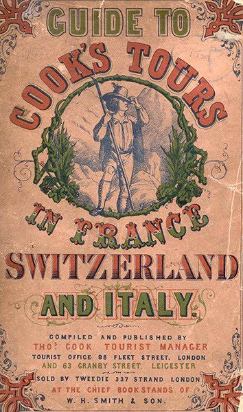
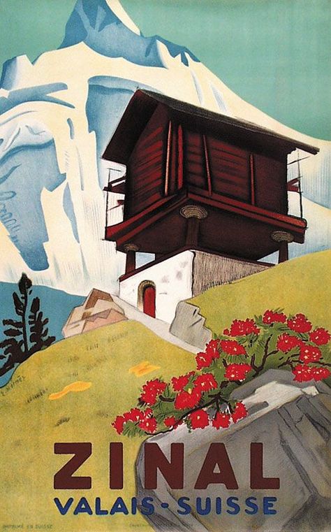
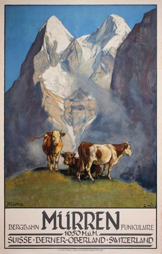
The three images below are, from left to right, from 1897, 1865, and likely the early 19th century. The house shown in the Zinal ad is typical of Wallis (Valais in French): It is built on stilts with round, flat stones between the pillar and house base; we chatted with an elderly man when we were on holidays in the region and asked him about it; it is a way to keep rats and mice out of the houses. It also means that the back, and sometimes even the front, is only accessible by ladder.

The 1865 poster is about a tour organized by Thomas Cook, a well-known name in the British travel industry even today; Cook took his first tour group of around 485 people on an 11-mile train trip from Leicester station to Loughborough, in 1841. Soon, he began to expand his scope, and by the 1860s, that included Switzerland.

The Spiez poster below shows the castle and lake; The Zürich poster shows a view over Lake Zürich from atop the Uetliberg mountain, the summit of which is called Uto Kulm. To see a live-cam panorama from that vantage point, just click here. The Mürren poster is a view typical of every Alpine pasture, even today.

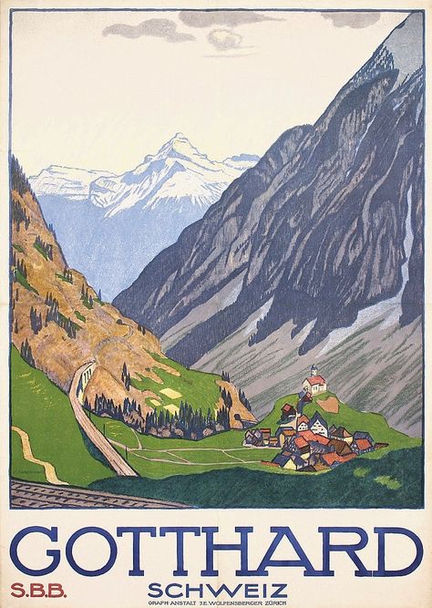
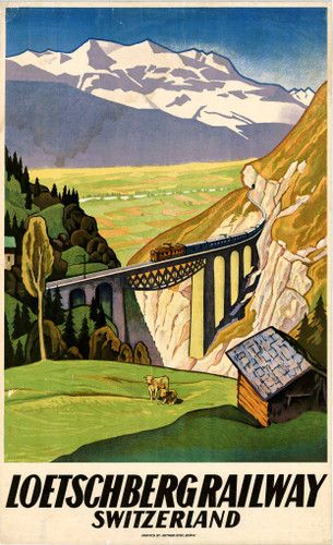
The next 3 images are firmly in the Alps: The glacier shown in the first image is the Aletsch Glacier, the largest in the Alps, covering around 80 square kilometres (31 m2), with a length of ~23 km (14 miles) with a maximum thickness of ~1 km of ice. As with most glaciers in the world, it is retreating. Gotthard (officially the Saint-Gotthard Massif) is an impressive region connecting north and south Switzerland between Uri and Ticino, German- and Italian-speaking cantons, respectively. It has long been a major axis of Europe, with a road across, a vehicle tunnel through (built 1980), a cargo and transport train tunnel (opened 1882), and now a passenger- and vehicle-transport train tunnel which opened in 2016 and is the world’s longest railway tunnel and the deepest traffic tunnel, as well as the first flat low-level tunnel through the Alps. The 3rd poster highlights the Lötschberg, a massif with a train transport tunnel linking the north and south of Switzerland through the Berne and Valais routes. We often take this route when going to Valais or Ticino on holidays; the train is an open, continuous carriage, meaning you drive on, sit in your car, and watch the tunnel fly past.

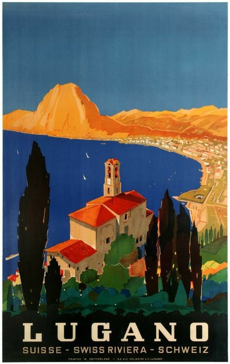
The next 3 posters highlight something nearly ubiquitous in Switzerland: Lakes. They’re everywhere. We even share Lake Constance with Germany and Austria, and Lake Geneva with France. From border to border, we have over 100 main lakes and countless smaller ones (in an area what easily fits within the state of Maine, US, to give you a size comparison). The first poster is encouraging locals to explore, commemorating the 650th anniversary of the formation of the core of Switzerland. The second shows Lake Lugano from the perspective of Monte Bre, with the city of Lugano along the shore. It’s a perspective I know well, as the family had a holiday home on the flanks of Monte Bre until last year. San Salvatore is the mountain peak shown. The third poster is of the Vierwaldstättersee (“Lake of the four forested settlments”): This is the most complex lake in Switzerland, and not only for its names: In English it’s known as Lake Lucerne, although that is just one arm of the sprawl. Sections are Lake Lucerne, Lake Urner, Lake Kussnacht, Chrüztrichter and Lake Alpnacher. The many-armed lake is shared by the cantons of Uri, Schwyz, Obwalden, Nidwalden (originally one canton known as Unterwalden) and Lucerne. Signs of settlements found by archaeologists go back to at least 3,000 BC. To see this lake through live-cams, just click here. The site is in German, but just click on the view you’d like to explore.

I hope you’ve enjoyed this virtual tour! And perhaps you’ll come to Switzerland one day to see it for yourself!

2 Comments

Filed under Articles, Etymology, Family History, History, Links to External Articles, Nature, Snapshots in History, Virtual Tours

History Undusted: The Age of Revolutions

This past summer, my husband and I rented a motorhome and travelled around Switzerland; we tend to prefer nature or museums to overly-touristy attractions. One of the places we visited was Spiez Castle. Before I tell you about that, however, a little historical backdrop is necessary, so buckle up and enjoy the ride!

Everyone’s heard of the French Revolution, which began in May 1789: It was a struggle to become free from the heavy yoke of an elitist monarchical regime, quasi out of the frying pan and into the fire of the Reign of Terror – during which many of the original rebels, in a twist of morbid irony, also had their heads removed by Monsieur Guillotine; it ended in November 1799 with the abolition of the Ancien Régime and the creation of constitutional monarchy (not far from where they started) and the French Consulate (which lasted nearly 5 years until the start of the Napoleonic Empire in May 1804).

But what many people might not know is that the French Revolution was internationally both influenced and influential. Modern “small world” effects are not modern at all; even in ancient times, people had international news: Travelling merchants and traders, messengers, signal towers (such as those the Romans used along the British frontiers), and even smoke signals, all conveyed news. When the French Revolution began, there was already a growing political dissent spreading throughout Western Europe; the English “coffeehouse culture” enabled men to gather in small groups and discuss business and politics; this concept travelled to America, and the discontent culminated in the American Revolution, starting in April of 1775. The French people watched and learned. The British government naturally became wary – they were losing the American colonies to the Revolutionary War, which they finally lost in September 1783. The Americans were supported during that time by France and Spain (the two main long-term enemies of Britain), so the British were hemmed in by threats to their own social order from both the east and the west, and they had well-founded fears of the discontent sparking revolt in the dry tinder of their own oppressed ranks.

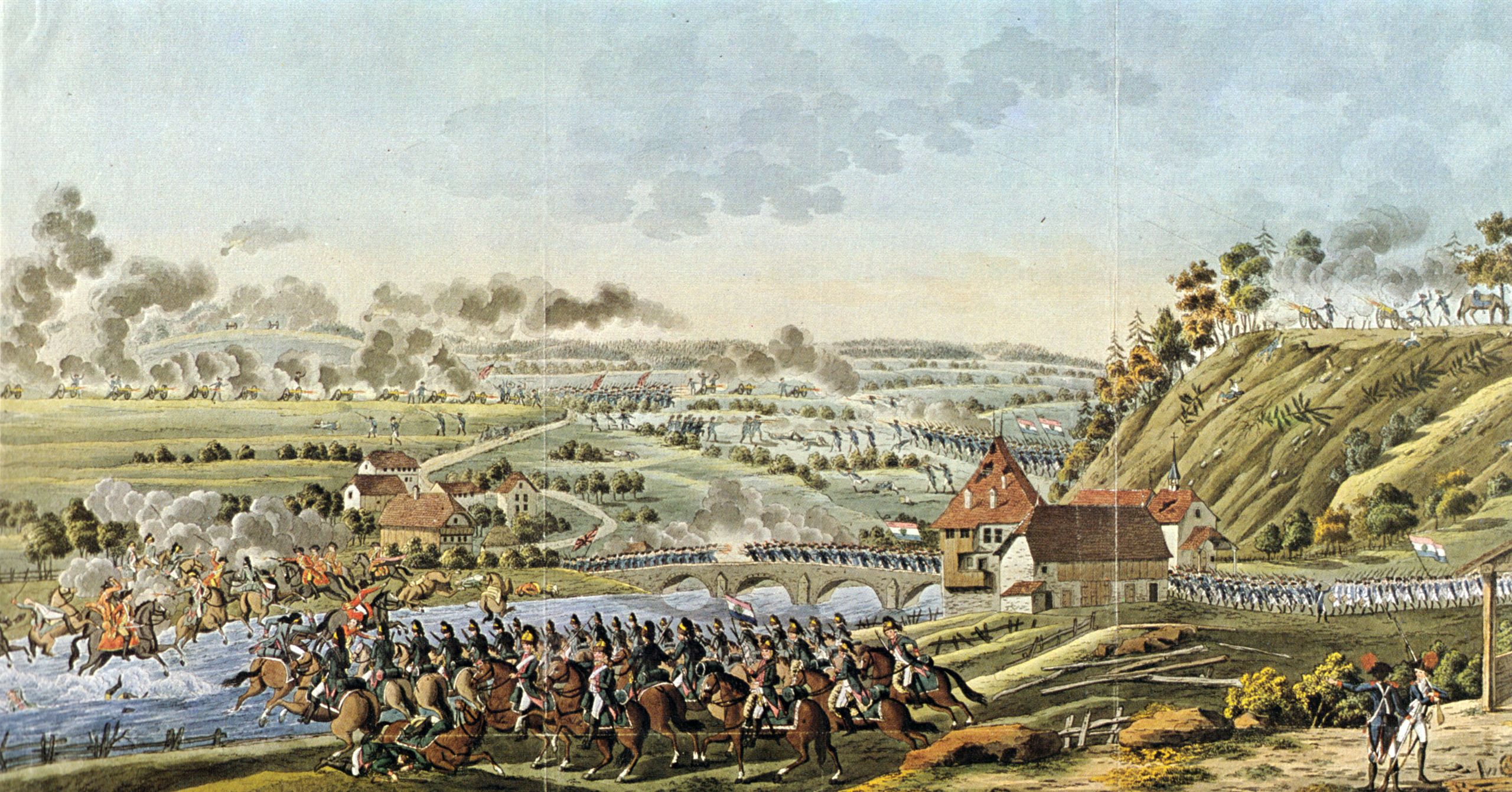
And now we come to Switzerland: To understand the Swiss backstory in a nutshell, which does no justice to a history that began in the Palaeolithic Age or further back, let me sum it up: The Old Swiss Confederacy was an alliance between independent small states, starting on 1 August 1291 with the “Rütlischwur”(an oath of allegiance between the cantons of Uri, Schwyz and Unterwalden), which date is considered by the Swiss to be the birth of the nation (though history is more complicated). As the French Revolution was beginning to wind down, Napoleon Bonaparte, then a French general, pressed the French Directory (the then-current French governing committee) to invade Switzerland. The atmosphere within the Old Swiss Confederacy was tense, fearing that the French Revolution would spill over with or without direct French military involvement. At the invitation of a French-speaking faction in Vaud (then part of Canton Berne), 12,000 French troops invaded through Vaud on 28 January 1798, and for the next four months, battles were waged between the French and the Swiss “Loyal Legions”. It ended in May with the swift collapse of the Swiss Old Confederacy.  

The Battle of Neuenegg, 1798 – Graphics Collection, Central Library, Zürich

However, the French Directory needed a solid neighbour, a buffer zone along their eastern borders, not a loosely associated collection of small states; they tried to steer toward a re-establishment of national unity with a Paris-drawn constitution, but on April 1798, Swiss cantonal leaders proclaimed the Helvetic Republic, with new legal structures that abolished feudal rights within individual cantons in favour of a national unity. A few battles later, and coalition armies waging war in and around Switzerland against France, eventually left Switzerland as a sovereign, neutral nation; it has remained so ever since, despite two world wars.

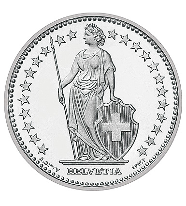
An etymological side note on the Latin name of the Swiss Confederation (Switzerland), Confoederatio Helvetica: Helvetia is the female personification of Switzerland, found on nearly every coin, much like Lady Liberty of America. The name derives from Helvetii, a Celtic tribe that inhabited the Swiss Plateau since before the Roman Era. The earliest reference of the name is dated to ca. 300 BC, written in Etruscan on a vessel from Mantua (located in Lombardy, Italy). By the time the Romans arrived, they were well-established tribes governed by noblemen; the Roman historians tended to refer to anyone not Roman as “barbarian”, which tends to skew modern understanding of the peoples they conquered; it was perhaps their way of justifying invasions against peaceful, intact civilisations. Naming no names, but R—– is repeating that same shameful tactic today; there’s nothing new under the sun.

It’s easy to overlook the complexities of historical events or view them from only one nation’s side; after all, as Mark Twain once wrote, “The very ink with which all history is written is merely fluid prejudice.” History’s angle is in the hands of those who wrote it – if they were Roman, everyone else was barbarian; if they were English, the Scottish / Irish / Indians were backwaters in need of a guiding stick, and so on.

So, now that you know a bit more about the history in and around Switzerland, I’ll highlight Spiez Castle next!

3 Comments

Filed under Etymology, History, History Undusted, Military History, Quotes, Snapshots in History

History Undusted: Rabbit Holes & Licorice Candy

This week, I did a major shopping at a couple Asian food stores; I stocked up on the ingredients I know, and some I didn’t; I like to get things I’ve never heard of, and do a bit of research on how to use it in cooking; things I picked up in that category are Iranian Kashk, which is a tangy fermented, yoghurt used as a condiment; canned palm hearts, which make a nice topping on desserts; and fermented black beans, which can be used in a variety of Asian dishes, including in a black bean sauce. I also bought several fresh vegetables and herbs to dehydrate and turn into a greens powder for adding flavours to dishes (I have a more usual greens powder with standard greens, like cauliflower leaves, spinach, etc. that I use daily).

One of the herbs I used was acacia leaf: When I opened the package, a pungent, sulphur-like smell hit me, and I wasn’t sure I’d use it. But when I began de-leafing it (much like you would thyme, though carefully as it’s got some vicious thorns!), it began to smell like mint! As I added lemongrass, Thai water spinach and other herbs, you can imagine the cacophony of fragrances in my kitchen – which filled the house as they dehydrated.

So what does this have to do with licorice? Well, one of the fresh herbs I also processed was Thai basil; I’d never used it before, and when I opened the packaging, a wave of anise- or licorice aroma hit me. And as usual, that set my mind off, thinking about the history of licorice!

Licorice is a flowering plant native to parts of Asia and Europe; its scientific name, Glycyrrhiza, comes from Greek and means “sweet root” (the linguistic roots are related to words like glycerine and rhizome); it is the ingredient that gives the signature flavour to black licorice, though today anise oil is often used as a substitute because the Glycyrrhiza can have toxic effects if ingested too much.

In looking into the history of this flavour, I came across a fascinating documentary: Ostensibly, it covers the history of the Switzer Licorice candy company. But in truth, it’s a fascinating historical insight into the history of Irish immigration, social unrest, the Irish famine, Irish revolution and exile, union labour foundations, World War 1 through the eyes of a family, the economic upheavals of war, rations and the company’s creative solutions, the history of sugar, post-war recovery, the Great Depression, the American Dream, candy-making, the rise of a family from Kerry Patch (the Irish ghetto of St. Louis, Missouri) to the suburbs, the history and development of St. Louis, and the demise of a family company resurrected by later generations. All in a 55-minute video!

 To watch this fascinating slice of history, click here. To check out the company’s website, click here.

I hope you enjoy this short history, and while you’re at it, enjoy a piece of licorice!

Image Credit: Switzer website (see link above)

Leave a comment

Filed under Articles, Etymology, History, History Undusted, How It's Made, Links to External Articles, Military History, Science & Technology, Snapshots in History, Videos, YouTube Link

History Undusted: The History of Money in the American Colonies

Today we’ve got a variety of ways to make financial transactions: Online payment, cheques (checks), cash (coins or bills), debit cards, giros (UK), credit cards, bitcoins, Twint, and probably a dozen other ways. But when did it all get started? Why are there ridges or texts on the edges of coins? What did people use before coins were widely spread enough to be a viable means of transaction? I’ve written about the history of shillings before, and ancient payments using hack silver, but the complications that arose across the Atlantic between the British crown and the colonies of America, before they won their independence, is as fascinating as any thriller. It’s a tale of laws passed to stranglehold the colonies into submission or to stop an artery bleed of silver across the ocean, and loopholes and nooks and crannies found to carry on with business anyway.

For a fascinating video on the topic by Jon Townsend, an 18th-century reenactor and specialist with a great YouTube channel, just click on the image below. Enjoy travelling back in time!

Leave a comment

Filed under History, History Undusted, Military History, Snapshots in History, YouTube Link

History Undusted: Forgotten Battles of the Aleutian Islands

I might be odd for a woman, but I love history; in particular the history of World War 2. But as much as I’ve read about it, and as many documentaries and films as I’ve watched on the topic, I had never heard about this episode until I read a comment from a YouTube video which told about how that person’s grandfather had served in the only US territory to be occupied by the Japanese during the war: The Aleutian Islands.

Anyone who knows a bit about World War 2 probably knows about Midway – a pivotal point in the Pacific arena. But at the same time Japan was targeting that US island base in the middle of the Pacific, they also had their sites set on the Bering Strait; specifically, the six island groups of the Aleutian Islands. In June 1942, they attacked and occupied the US territory islands of Kiska and Attu. Anyone would be excused for thinking that these inhospitable, frozen, volcanic mountains rising out of the sea were insignificant, but they were a strategic launching point for keeping the Japanese at bay in the Pacific, and as a gateway for supplies to the Allied troops. If the Japanese managed to maintain their hold on those islands, it would strengthen the defence of their northern territories, and it was also feared that they would use the islands as springboards from which to attack the US West coast or invade through Alaska and into Canada and the northwestern mainland territory of the US. The battles there are considered the “forgotten battles” because, although there was public outrage in the US at the time, they were soon largely overshadowed in the press by Midway and by the Guadalcanal campaigns. But the number of casualties there was comparable to that of Pearl Harbor, and the Attu battle was better known in Japan than in America: It was a major propaganda coup for the Imperial Army.

To watch a 1943 documentary about the Aleutian Islands and their strategic significance, called “Forgotten Battle of the Aleutian Islands“, just click on the link (~45 min.). It not only gives a glimpse into the geography and military aspect, but the human aspect, showing the soldiers in their daily off-duty activities and their duties; it gives you a sense of what they were like, where they came from, and what they did. For a shorter summary (~12 min), click here.

The Aleutian Islands, showing Russia to the west and Alaska to the east.

1 Comment

Filed under History, History Undusted, Military History, Snapshots in History, Videos, YouTube Link

Famous Last Words: Major General John Sedgwick

Killed in the 1864 Battle of Spotsylvania by a sharpshooter, his ironic last words were:

“They couldn’t hit an elephant at this distance.”

Major General John Sedgwick; source, Wikipedia

3 Comments

Filed under History, History Undusted, Quotes, Snapshots in History

History Undusted: Limbo

Over the past year and more, we’ve all experienced limbo in one form or another: Lock downs, restrictions, cancellations of events or flights or holidays or plans to meet up with friends, and the uncertainty of how long it will all last. Then there is the feeling of limbo that comes with my personal situation of waiting for the cascade of appointments for my husband’s chemo to begin; we had a set-back last week with a bacterial infection and a week’s hospitalization, so we’ll just have to wait and see if he can keep the appointments already made or not. Limbo. Waiting to find out if he can be brought home tomorrow. Limbo.

My writing, both in the forms of this blog and of my manuscript, have both been sucked into the state of limbo as well, as I’ve spent most of the past few weeks, and more intensively the past three days, on the phone with people who’ve asked how we’re doing, or answering messages on my phone or social media. Sometimes I feel like my manuscript is calling for me to work on it, and I’m trying to reach it while wading toward it waist-deep in a thick sludge of other priorities – it’s been just out of reach for days, because by the time I actually reach it, I have no energy left.

As I was thinking about those limbo moments, I actually started wondering just where the limbo dance comes from, historically; I remember doing it as a child – the local indoor skating rink played limbo every night. So, here’s a brief low-down on the low-down dance:

The origins are vague, as is the etymology of the name: Starting in late-1800s Trinidad, the name might have come from the Jamaican English “limba“, i.e. limber. Interestingly, the game is used in Africa as a funeral game, and there may be a connection between the two regions through the slave trade which brought Africans to the Jamaican islands, as it is also a popular “dance” for wakes in Trinidad. The rules are simple: a person passes under a bar, face-up, with the only body part allowed to touch the ground being the feet. The game is considered the unofficial national game of Trinidad and Tobago, it only began to gain popularity beyond the region in the 1950s; it was adopted in the mid-1950s as a form of physical exercise for American military troops. It was often attempted to a rhythmic song, and one of the most popular was the Limbo Rock, by Chubby Checker. Just listening to the song brings back the feeling of the cool breeze blowing around the skating rink as people sped to get in line for the limbo stick as soon as they heard the music start over the loudspeaker!

As we face our own times of limbo in this age of Corona, or in the circumstances we find ourselves in, perhaps it would perk up our spirits to hum the Limbo Rock and take it with a bow and a smile.

5 Comments

Filed under Articles, Etymology, History, History Undusted, Military History, Research, Snapshots in History

History Undusted: The Kindred Spirits of the Choctaw & the Irish

I recently heard of an unusual historical connection between a tribe of survivors from the Trail of Tears, and those struggling with survival half a world away during the Irish Potato Famine, 1845-1852.

The Choctaws were one of the Native American nations who were forcibly displaced between 1830 and 1850, along with Cherokee, Creek (Muscogee), Seminole and the Chickasaw nations. Basically, any land the white insurgents wanted, they took, driving out tribes from their ancestral homes; thousands died of exposure, starvation and disease on the road to their designated reserves.

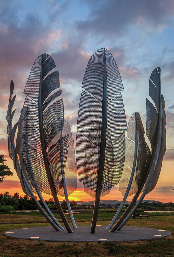
But in the midst of their own sorrows, the Choctaw people heard about the plight of the Irish famine, and they responded with generosity. They collected $170 (which would be around $5,200 today) and sent it to the Irish in 1847. While gifts flowed to Ireland from various sources, the gift of this native tribe touched the Irish deeply; despite their own tragedies, they reached out and gave the Irish people hope – hope that they weren’t alone and that others cared.

Fast-forward to the Covid-19 challenges facing many Indian reservations: Many people are unemployed and barely scraping by; a lack of running water or electricity is common, so you can imagine how challenging it is for them to keep their hands clean and to be able to meet hygiene requirements – as a result, the Corona Virus has swept through these impoverished communities. A Navajo woman, Ethel Branch, started a GoFundMe, hoping to raise money to help support reservation families; she set the goal at $50,000, thinking it was far too ambitious and expecting only about a thousand dollars to come in. But the Irish heard about it, and they’ve been paying it forward, back to the people they never forgot and who they teach about in their history lessons; so far, over $5 million has been raised.

For a short news report on the story, click here.

One tweet made all the difference in this new chapter of an intercontinental friendship. This story reminds me that when we respond with empathy and generosity, even the smallest acts of kindness can encourage others, and, as the saying goes, what goes around comes around.

Stay safe, stay healthy, and keep an eye out for those who need an encouraging word or deed – you may change a life.

Alex Pentek’s “Kindred Spirits” sculpture, County Cork, Ireland

5 Comments

Filed under Articles, History, History Undusted, Snapshots in History, Videos